- RankHotter than 91% of themOf the 8,970 stations reporting to us right now, only 799 are hotter.Today’s full leaderboard →
- The opposite of here78.5°C colderAmundsen-Scott South Pole Station, Antarctica is at −49.5°C at this same moment.Go to Amundsen-Scott South Pole Station →
Other conditions at this reading
- Dew point
- 26.0°C
- Humidity
- 84%
- derived from the temperature and dew point
- Wind
- Calm
- Pressure
- 1009.8 hPa
- altimeter setting, QNH
- Visibility
- 7.0 km
Where Yangon Intl stands
Its highest placing today was 281st of 5,130, reached at 06:00 UTC.
- Best global heat placing in 44 days recorded: 9th of 9,009.
- Reached the world's hottest 10 on 1 of those 44 days.
- Was the hottest reporting station in Myanmar on 44 of those 44 days.
Ranking as of 09:45 UTC.
☀️ How 29.0°C comparesA typical March afternoon in Majuro.Majuro, Marshall Islands, typically reaches 29.0°C in March, averaged over every March day its archive holds. Not a published climate normal: it is the mean of what we hold.
The last 24 hours
Local timeThe record book, month by month
Highest and lowest ever recorded here · with the day it happenedJan
39.0°
Thu 18 Jan 1996
10.0°
Sun 13 Jan 2013
Feb
39.8°
Wed 27 Feb 2013
9.1°
Sun 9 Feb 1997
Mar
40.4°
Mon 22 Mar 2021
15.5°
Thu 6 Mar 2008
Apr
43.0°
Fri 10 Apr 1998
15.5°
Sun 6 Apr 2008
May
42.5°
Record high
36.0°C
Tue 7 Nov 2023
Record low
18.4°C
Sat 7 Nov 2009
Average high
33.2°C
all years on record
- 1
Between its coldest night and its hottest day, this place has swung 33.9°C.
From our dataRecord high 43.0°C against record low 9.1°C. - 2
At 06:30 it was 25.0°C. By 15:30 it was 29.0°C. The night never stood a chance.
From our dataToday so far at this station, in local time.
New facts every day. Report an error.
7.0°C short of the record for 7 November
Today’s high 29.0°C against 36.0°C in 2023. A reading that beats it is flagged here automatically, once a second cycle confirms it.
All-time record high
43.0°C
- Date
- Friday, 10 April 1998
- Time of day
- Not recorded. The daily archive stores the day, not the hour.
- Location
- Yangon Intl, Myanmar (Burma)
- Position
- 16.91°N 96.14°E · 31 m
The highest in available records since 1954. Source: GHCN-Daily, 1954 to 2025.
All-time record low
9.1°C
- Date
- Sunday, 9 February 1997
- Time of day
- Not recorded. The daily archive stores the day, not the hour.
- Location
- Yangon Intl, Myanmar (Burma)
- Position
- 16.91°N 96.14°E · 31 m
The lowest in available records since 1954. Source: GHCN-Daily, 1954 to 2025.
By year, from our own record
2026
Highest 35.0°C, lowest 24.0°C, mean 28.8°C. 47 days recorded from 2,074 readings.
By month, from our own record
| Month | High | Low | Mean | Days | Readings |
|---|---|---|---|---|---|
| November 2026 | 35.0°C | 25.0°C | 28.9°C | 7 | 302 |
| October 2026 | 35.0°C | 24.0°C | 29.1°C | 31 | 1,413 |
| September 2026 | 34.0°C | 24.0°C | 27.8°C | 8 of 9 | 359 |
Means are of the readings we stored, weighted by how often this station reported, so they are not daily averages and not climate normals. Some days were recorded before we began counting observations and contribute their high and low but not the mean.
Highest and lowest we have recorded here
Highest
35.0°C
Mon 2 Nov 2026 at 12:00 local
Lowest
24.0°C
Wed 14 Oct 2026 at 06:30 local
These are not official records. They are the highest and lowest readings this site has stored for Yangon Intl since September 2026, across 47 days we hold a reading for. Official climatological records are adjudicated by national meteorological services and by the WMO.
Yangon Intl (VYYY) is a METAR weather station in Myanmar, 31 m above sea level, about 2 km from Saw Bwar Gyi Kone.
We have kept a daily record here since 22 September 2026, every one of the 47 days this site has existed. We have stored 2,074 observations across the 46 of those days for which we also recorded a count.
Recent temperature history
The same record at three widths, picking up where the last 24 hours above leaves off. Each period is summarised from the grain that suits it, so nothing here is one reading repeated thousands of times into the page.
Recent readings
Each reading as it arrived, newest first, with what our quality checks did with it. A reading we did not count is shown struck through with the reason.
| Time | Temp | Change | Status |
|---|---|---|---|
| 29.0°C | 0.0°C | Counted | |
| high | 29.0°C | 0.0°C | Counted |
| 29.0°C | 0.0°C | Counted | |
| 29.0°C | 0.0°C |
In summary
Over the last week we have readings for 7 days here, running from 25.0°C to 35.0°C, a spread of 10.0°C.
It reports about every 30 minutes, and sent 48 readings in the last 24 hours.
Its best placing today was 281st hottest of the 5,130 stations reporting.
What stands out here
- Its best placing so far is 9th hottest of the 9,009 stations reporting worldwide. It has reached the world's hottest 100 on 35 days.
- It has passed 30°C on 6 of the 7 days we have recorded here.
Recent highlights
Entered the ten hottest reporting stations on Earth, reaching 9th of 4,948.
Entered the hundred hottest reporting stations on Earth, reaching 38th of 5,167.
Fell to 24.0°C, its lowest of October, beating 26.0°C on Thu 1 Oct 2026.
Recent days
A reading on every one of the last 30 days. Typically 47 readings a day.
| Day | High | At | Low | At |
|---|---|---|---|---|
| 2026-11-07 | 29.0°C | 09:00 UTC | 25.0°C | 00:00 UTC |
| 2026-11-06 | 32.0°C | 05:30 UTC | 25.0°C | 23:00 UTC |
| 2026-11-05 | 34.0°C | 06:30 UTC | 26.0°C | 19:00 UTC |
| 2026-11-04 | 33.0°C | 04:00 UTC |
Nearby, and the opposite
- Nearest stationMingaladon27.7°C5 km away, today's high
- Warmest nearbyBago30.0°C61.1 km away
- Coldest nearbyHMAWBI24.0°C25.3 km away, today's low
- The opposite of hereAmundsen-Scott South Pole Station−49.5°CAntarctica
What we have stored, day by day
We have readings for every one of the 47 days since we started storing this station on 22 September 2026.
Tracking history
It has reported on every day since Tue 22 Sep 2026.
- First reading stored28.0°C on our first day here
- 100 readings storedfired late: 1 earlier day(s) carry no reading count
- First time in the hundred hottest reporting stations56 of 5,098
- 1,000 readings storedfired late: 1 earlier day(s) carry no reading count
- 30 days reporting without a gap
- First time in the ten hottest reporting stations9 of 4,948
Where this station is
This station lies about 1,900 km north of the equator. It lies within the tropics.
Where Yangon Intl is
z6
16.91°N 96.14°E

























Yangon Intl
Ground · satellite
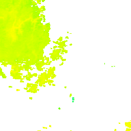
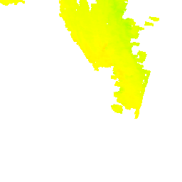
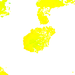
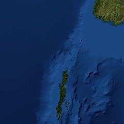
Land surface temperature for 2026-11-06, from NASA GIBS. This is the temperature of the ground seen from orbit, not the air, and it is never ranked against air readings. Cloud hides the ground, so gaps are unread rather than guessed.
View more on Google Maps16.9060°N, 96.1370°E
Yangon Intl, answered from the data
How hot does it get in Yangon Intl?
The warmest month on record here is April, when the highest reading has reached 43.0°C (109.4°F) on Friday, 10 April 1998.
NOAA GHCN-Daily, highest reading recorded in each month
How cold does it get in Yangon Intl?
The coldest month on record here is February, when the lowest reading has fallen to 9.1°C (48.4°F) on Sunday, 9 February 1997.
NOAA GHCN-Daily, lowest reading recorded in each month
What is the highest temperature ever recorded in Yangon Intl?
43.0°C (109.4°F) on Friday, 10 April 1998. That is the highest in the daily record we hold for this station, which runs since 1954. It is not an officially certified record unless a meteorological authority has recognised it.
NOAA GHCN-Daily
What is the lowest temperature ever recorded in Yangon Intl?
9.1°C (48.4°F) on Sunday, 9 February 1997. That is the lowest in the daily record we hold, which runs since 1954.
NOAA GHCN-Daily
What is the temperature in Yangon Intl right now?
29.0°C (84.2°F), measured at 16:00 local on Saturday 7 November.
Live reading from the station, after our quality checks
Is Yangon Intl the hottest place on Earth?
Data sources for this page
Readings here arrive through NOAA METAR. METAR is the routine aerodrome weather report, issued for aviation, typically every 30 or 60 minutes and more often when conditions change. It updates far more frequently than a synoptic report, which is why these pages have a usable chart.
| Figure | Source | Type |
|---|---|---|
| Latest reading, today so far | NOAA Aviation Weather Center (METAR) and NOAA NWS WMO bulletins (SYNOP) | Measured, station |
| All-time, monthly and on-this-day records | NOAA NCEI Global Historical Climatology Network daily (GHCN-Daily), 1954 to 2025 at this site and its predecessors, and our own observations, 47 days | Measured, station |
| Nearby stations and distances | Computed from station positions in our own database | Calculated |
How these readings are checked
Every reading on this page has passed the checks below. A reading that fails any of them is stored as refused and can never be ranked, shown as a record, or counted in a daily high or low.
No reading from this station has been refused in the last 14 days.
- 01
Has a real position
A reading with no usable latitude and longitude is discarded. It cannot be ranked, mapped, or compared with its neighbours, and a temperature with no place is not an answer to which place is hottest.
- 02
Position is not a placeholder
Some feeds fill an unknown position with a stand-in value such as 99.99 degrees or an elevation of 9999 m. Those are not coordinates. They are caught separately from a missing position because a station placed at a fake point has no neighbours, so the neighbour check below can never see anything wrong with it.
- 03
The bulletin itself is current
SYNOP arrives as files that are only re-read when they change. A file that has stopped being updated is set aside whole, before any reading inside it is considered.
- 04
The reading is recent enough for its network
Different networks get different windows, because they report at different rates: 2 hours for METAR, which transmits continuously, and 9 hours for SYNOP, which reports at 00, 06, 12 and 18 UTC. A single rule would have discarded the entire synoptic network, including every station in Antarctica.
- 05
Inside the range of measured temperature